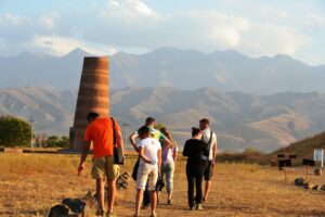
Ak-Talaa. 90 km west of Naryn. It is known as the birthplace of Togolok Moldo, which is printed on the 20 som banknote. There are many mineral springs and therapeutic mud here.
The Ak-Talaa zone includes the valleys of the Ala-Buka, Arpa, Terek rivers and the southern slopes of the Moldo-Too ridge within the middle course of the Naryn river. The center of the zone is the district center of Baetovo. Within the zone, the Naryn River absorbs many large and small tributaries, as a result of which it becomes turbulent and full-flowing. Over many millennia the river has cut a huge canyon between the northeastern tip of the Ak-Shyirak Ridge and the spurs of the Moldo-Too Ridge. Its steep, layered sides in some sections are separated from each other by many kilometers. Because of a rather steep gradient, the water in the river rushes at a speed of up to 60 kilometers per hour. In some places, the river channel narrows to a dozen meters and the height of the water column reaches 30 m.
In the floodplain of the river Naryn between the mouths of the rivers At-Bashi and Ala-Buka located hunting farm “Ugyut”, which organizes licensed hunting for some animals, mainly ibex and puffins.
Coastal terraces of Naryn are used for agricultural land. Foothill landscapes of the southern slopes of the Moldo-Too ridge are represented by sagebrush semi-deserts. Above, tipchak and feather-grass steppes begin.
Wide, in some places overgrown with forests, the gorges rise steeply to the ridge, narrowing in the upper part to narrow rocky corridors. The streams with cold water flow in the gorges, which, in some places, tear down from the picturesque rocks as cascades of waterfalls.
The left tributaries of the Naryn – Ala-Buka and Terek – run through the valley with the length of 170 km and a width of 50 km. The valley floor rises from 1,500 to 2,600 m. It is framed by ridges Jaman-Too (4,718 m), Baibiche-Too (4,066 m) and a small ridge (about 40 km) Ak-Shyirak (average height 3,400 m). Floodplains are green poplar and willow forests with an admixture of birch and brushwood. The name of the river, Terek (“poplar”), indicates the dominant tree species in the floodplain forests.
In the valley, steppe vegetation is represented by bluish wormwood, sheep fescue and feather grass, and higher by rich herbs (geraniums, yarrow, cornflower, snakehead, scabiosa). In early summer, the steppe blooms with numerous flowers of iris, onion, saffron, sedge, buttercups, tulips, then cornflowers, ziziphora, thyme, sage, yellow anemones bloom. In the foothills there are thickets of chiy and low shrubby Karagana.
The slopes of Ak-Shyirak, Baibiche-Too and Jaman-Too mountain ranges with northern and western exposure are better moistened, and on them grow masses of riparian thickets of juniper and other tree species.
Abshir Say
Abshir Say, a tract. It lies at an altitude of 1,500 to 2,500 meters above


